TRAILS
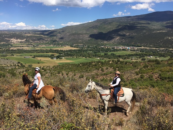
Did you know that our Roaring Fork Valley Guides & Outfitters keep many trails open for their commercial businesses, therefore they keep our trails open for hikers and equestrians.
Many sections of our Wilderness trails could not be safe, or passable for hikers/equestrians without their help. Please support the outfitters
and book a trail ride you will never forget! Tell them the RFVHC sent you!
HUNTERS : Ask about the Outfitters fully guided Hunts, Drop Camp Hunts and Packing Services.
Avalanche Outfitters at Redstone Stables, Coal Basin, East Creek Pass, Hawk Creek, Perham Creek. the Avalanche Creek drainage and also the Braderich Creek and Hayes Creek areas 970.963.1144
Capitol Peak Outfitters, Sopris, Woody Creek, Lenado, Hunter Creek, Hell Roaring & Avalanche
Creek area. John Howe: 970.928.0723
Maroon Bells Guide & Outfitters @ T Lazy 7 Ranch at the mouth of the Maroon Bells Wilderness, Willow Lake
Trail & Crested Butte Two-Day Overnight Rides. 970.920.4677
Snowmass Creek Outfitters St.Benedict's Monastery & McCabe Ranch, Main Snowmass Creek Trails, West Snowmass Creek Trails, East. Snowmass Creek Trails & Snowmass Village. 970.704.0707
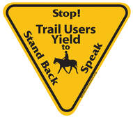
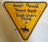
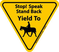
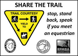
SIGNS BEING MADE...it took years to copyright our sign
Go to the Trails Safe Passing Plan (TSPP) Page on our website CLICK HERE https://www.rfvhorsecouncil.org/trails-safe-passing-plan-tspp.html
In addition to the news of our sign, the research you find throughout the website may be useful to you in your area. Remember, if the author of a story is listed, or the publication is named on our stories, we ask that you give credit to those who wrote it!
In addition to the news of our sign, the research you find throughout the website may be useful to you in your area. Remember, if the author of a story is listed, or the publication is named on our stories, we ask that you give credit to those who wrote it!
The winter version of the 2021-22-23 RFVHC Survey about RFV Trails
for Equestrians and Hikers here:
https://www.surveymonkey.com/r/JL23DN3
YOUR OPINION MATTERS... With the release to the general public of the 2021 - 23 RFVHC sponsored Trails Survey Monkey Questionnaire for hikers and horseback riders, we want to thank the respondents - a cross representation of trail users that are helping the RFVHC and our community land managers by giving feedback about 12 RFV trail areas. If you did not participate, we ask for 10 - 15 minutes of your time.
Every single piece of advice in the written comments will be carefully considered to help make our trails, parking. safety and signage better.
And a critical component is the communities interest is keeping wildlife safe and able to thrive. What are your ideas?
The RFVHC Survey Monkey Hiker and Horse Trail results are being to the Land Managers in charge of the area trails. The reports are beautifully illustrated and will be helpful in making our trails better for equestrians. The Glassier Equestrian Trail is a favorite and when it comes up for a new land management decisions - we hope each of you will speak up to keep it for equestrians and hikers only. No bikes. The fact is, it’s protected now, but cannot be made a permanent trail like Nancy’s Path. Please help us keep Glassier Equestrian Trail open to hikers and horses only.
E-BIKES and the BCHA and RFVHC
If your bike gets you places you can't get to yourself on a mountain bike - your bike is motorized! Label IT! As some say, stop pretending
Here is the most recent LINK to the EBIKE STATUS by Back Country Horsemen of America (BCHA) For Equestrians, and now from the RFVHC to you- our RFVHC Membership.
Become a member today your local BCHA and learn in this video what our industry is doing. https://www.youtube.com/watch?v=60ItKbjd5bI
ON THE SUBJECT OF E-BIKES....
Here is our 2.6.2023 Letter to RFV Land Managers & Partners
TRAILS PAGE - Send us photographs of your special rides and stories
A 12.1.2020 RFVHC Letter to our community helped protect our wildlife
CRITICAL WINTER TRAIL CLOSURES
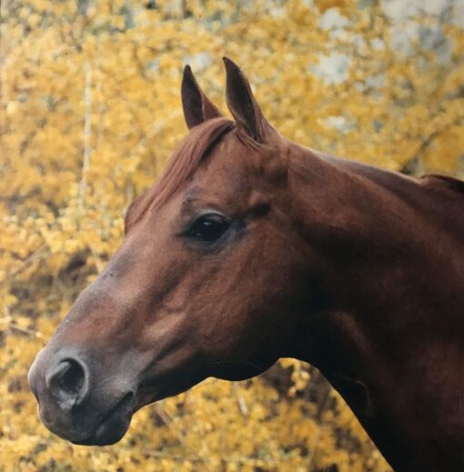
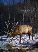
The photo on the left is Fulrak - he is quite handsome, isn't he?
8 points on one side, 6 on the other...photo by Greg Poschman
The RFVHC TRAIL RIDE PASSPORT -
We want details about Trails you love to hike and trail ride
We want details about Trails you love to hike and trail ride
We are organizing information for our website on our local horse trails and ask for your help. Send us an email with a couple of paragraphs….sentences….lists…bullet formats….or long storied descriptions of your favorite trails...where did you start...., was it a loop?...., how long did it take you and did you stop for lunch? And importantly – if there is a trail you love that has downed trees or difficult parking – we need to know. We have funding, and we have land managing partners that can help us improve trails where there is a need. Asking you -our members – is the best way to be able to tell the stories of our trails. From the old days to our summer days – we’d sure appreciate your help! The RFVHC is looking for members to serve on our new trail committee. . Check out our Face Book page for more items of interest to trail riders! We wish you amazing rides! Contact us on our website or Face Book page.
Basalt Mountain
Basalt Mountain
- Basalt Mt.#1911 East Creek Trail, West Fork Trail and Capitol Lake. This area is popular with horseback riders, hikers, and backpackers. Directions: From Carbondale take Hwy 82 east to El Jebel and turn left at the Shell gas station and head up through El Jebel and Missouri Heights for approximately 6 miles past Spring Park Reservoir. Here the road forks. Take the right fork onto forest road #509 for approximately 2 miles to the intersection of Cattle Creek and Basalt Mountain Roads. Turn right on road #524 and go 6 miles to the top of Basalt Mountain. The Trail starts by a locked gate and the bulletin board is 300 feet past the cattle guard on the top. Did you know that his trail travels mostly through lodgepole pine and open meadows. The first two miles follows old logging roads with carsonite posts with arrows marking the route. There are two overlooks into Cattle Creek in the first mile with nice views. At the end of the trail you have two options: you can turn north onto Cattle Creek Trail which is 4 miles of rolling decent to Forest road #509 and 2 miles of road to the Basalt Mountain road. Your other option is the Red Table Trail. It is 1.6 miles to Toner Reservoir. The trail crosses the dam to the east side, then north with the grass growing over the trail making it difficult to see. After the reservoir it is a steady 3 mile climb of 2000 feet elevation gain to a road on Red Tables with a couple of great views on the way.Difficult.
Cattle graze in the area making lots of trails, so carry a compass and map to find your way. Please leave gates in the position that you found them. For safety, bicycles and hikers must yield. to horses. Keep your speed down and ride safely. To protect wildlife please leave your dog at home, this is an important wildlife area for elk. This trail should not be ridden prior to June 21st to avoid disturbing calving elk. Water is non-existent, so plan accordingly.
- Cattle Creek # 1909 This area is popular with Hikers, Horses and Bikers.
Directions: From Carbondale follow Hwy 82 east and turn left at the stoplight at El Jebel. Go through El Jebel and travel about 5 miles on county road 13 to the Basalt Mountain Road (509). Turn right onto road #509, proceed 2 miles and take the left fork, which immediately goes downhill. At the bottom of the hill is cow camp, go right and follow this road about 2.5 miles to an old wooden locked gate. The trail starts approximately 50 feet south of this gate. Please park in the new parking lot 300 feet back. Note: Road #509 is impassable when wet past the intersection with the Basalt Mountain road #524 Did you know that this trail travels through aspens and meadows with patches of spruce and fir. It is hard to follow at times so be sure and carry a compass and map. Cattle graze in the area making lots of trails. Please leave gates in the position that you found them. For safety, bicycles must yield to hikers and horses. Keep your speed down and ride safely. To protect wildlife please leave your dog at home; this is an important wildlife area for elk. This trail should not be ridden prior to June 21st annually to avoid disturbing calving elk. Intermediate
Crown Mountain and the Mid Valley Trails
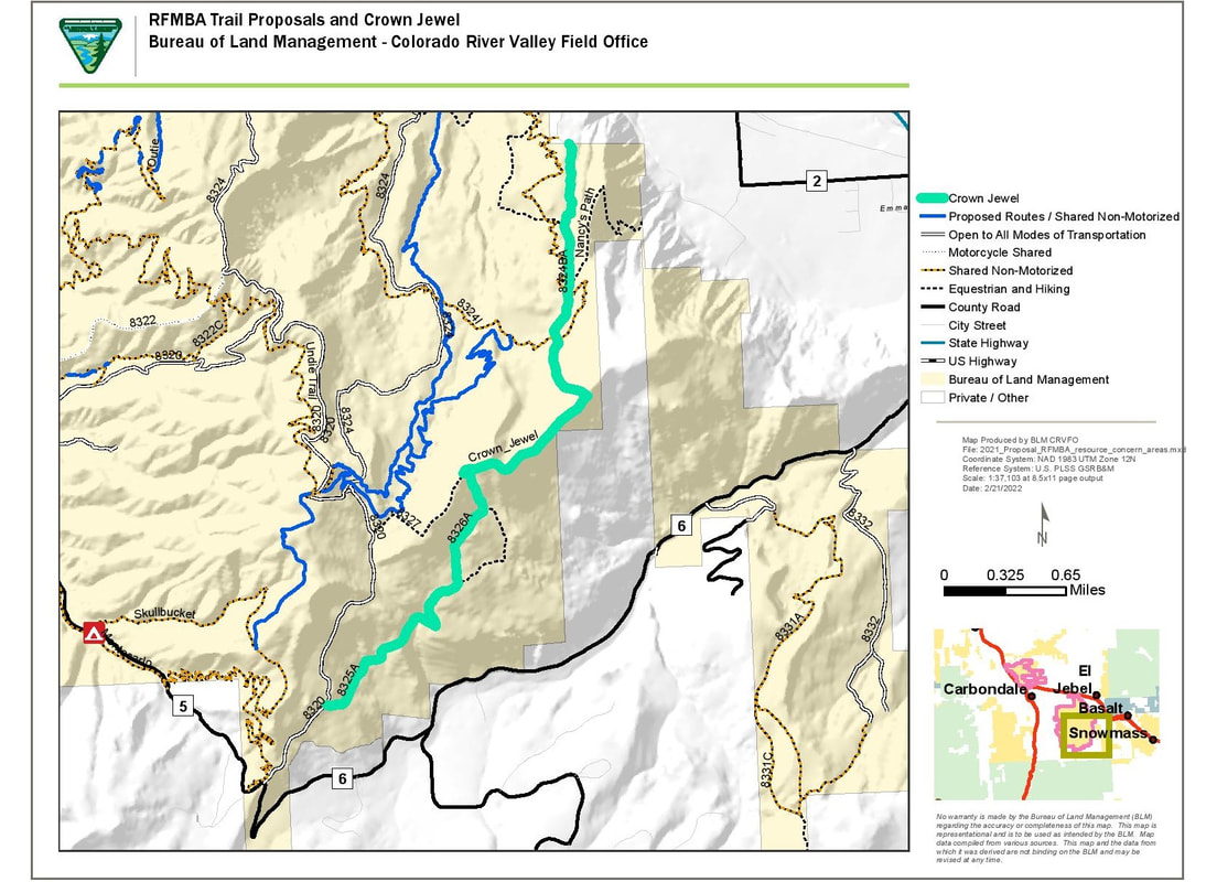
- The Crown Jewel Horse Trail (horses & hikers only) Directions: BLM's Divide Parking Lot is accessed from two locations: #1 – From Highway 82, to Route 133, then to Prince Creek Road to the Divide Parking Lot. #2 – Turn off Highway 82 at the Emma School House, taking the left fork, Sopris Creek Road; follow to the next fork; turn right on West Sopris Creek Road; follow to the top of the Divide Parking Lot. Did you know that the Bureau of Land Management's (BLM) Crown Mountain is a "Special Recreation Management Area (SRMA)" Mountain Bike Recreation area? There are now two hiker and horseback rider-only trails on the 9,100 acres of The Crown. The BLM Crown Jewel Horse Trail starts at the Divide Parking Lot and connects to the Pitkin / Glassier Equestrian Trail, ending at the Hooks Spur / Glassier Parking Lot. RFVHC collaborated with BLM to provide signage for the trails and each summer we work together to improve the trails for your use.graze in the area making lots of trails, so carry a compass and map to find your way. Please leave gates in the position that you found them. For safety, bicycles and hikers must yield. to horses. Keep your speed down and ride safely. To protect wildlife please leave your dog at home, this is an important wildlife area for elk. This trail should not be ridden prior to June 21st to avoid disturbing calving elk. Water is non-existent, so plan accordingly.
Crown Jewel - RFVHC SURVEY Results
- Glassier Equestrian Trail (horses & hikers only) Directions: Pitkin County Glassier Parking Lot is accessed from Highway 82, take the second exit at the El Jebel roundabout (Willits Lane) and follow until the bridge where the road forks, take the right fork onto Emma Rd. then turn right on Hooks Spur Lane and the parking lot will be on your right. Did you know a trail ride from the Pitkin County Open Space and Trail's (PC OST) Glassier Equestrian Trail to the BLM Divide Park Lot accesses the Crown Jewel Horse Trail? Shuttling horse trucks & trailers from the Pitkin/Glassier Parking Lot to the BLM Divide Park Lot (the final destination) makes the ride complete. On horseback, this ride takes about 4 hours with a 30 minute stop for lunch. This is a hike and trail ride you will never forget. RFVHC received a generous grant and collaborated with Pitkin County Open Space & Trails to improve the trail for equestrians and hikers. Each summer we work together to improve the trails for your use.
- Nancy's Path. (horses & hikers only): Directions: The Nancy’s Path Parking Lot only accommodates a few cars. Trucks with horse trailers cannot pull in and park in this area. Directions to hikers parking lot. Turn off Highway 82 at the Emma School House, taking the right fork towards El Jebel, (Emma Road) for 1 mile to the bend and the sign says Happy Day Ranch. Turn left onto the dirt road. Just up ahead is a red roof barn at the 4 way intersection. Turn right at the barn and just behind the barn is a small signed parking area and the trailhead. Did you know Nancy's Path can be reached via various trails, and truck and trailer parking is accommodated at the Glassier Trail Head Parking Lot and from the BLM's Divide Parking Lot (after an extensive trail ride from the Divide to get to the Nancy's Path turnoff). Nancy's Path is a seasonal trail ride, please use caution when condition's are less than ideal. From a user, "This is a very challenging trail. Our ranch uses it for cattle drives in spring and late summer. For users, they must be aware of ranch employees on 4-wheel drive vehicles and/or horses using the trails, and keep all gates closed. Cattle are grazing on the Crown all summer, and they have horns." The RFVHC recommends that this trail is not suitable for beginner riders or green inexperienced horses. Weather conditions can make this trail more difficult.
Crystal River Trail - Need INFO
Fisher Creek
- FISHER CREEK – FISHER CEMETARY – LOOKOUT MOUNTAIN - Cottonwood Pass has trailer parking at the turnoff for Red Mountain! I think small parking lots are a fair way of limiting users. Fisher Cemetery and Lookout Mountain. Both need more parking. Fisher Creek Trail - not much trailer parking, maybe can accommodate 2 or 3 trucks and trailers - nice ride, can go a very long way toward Glenwood Springs . . . Fisher Creek, sufficient parking available in 2 places, shared trails with hikers, bikers but not crowded. Love. Lookout Mountain!
Frying Pan River - Need Info
Glassier Open Space - See above under the Crown
Hay Park/Buzzard Basin Trail - Need Info
Light Hill Trail - Coming soon, a finished brand NEW equestrian and hiker trail! Beginning in 2018, working with BLM and PC OST. More details to follow! In 2023, the unfinished trail was ridden and this photo essay that is being used for PC OST, BLM, and Emma Caucus. Click HERE for a word doc or a PDF
Maroon Bells
- Lily Lake #1964 Hikers, Bikers and Horseback riders Directions: Travel south on Hwy 133 for 17 miles past Carbondale to Redstone. At the north end of Redstone take the 4WD road to the east up past the town's water plant to the East Creek trailhead, approximately a half mile from town. Travel up East Creek a half mile to the right fork onto Lily Lake trail. Did you know that the trail goes through areas of lush vegetation. Large, dense stands of trees make it a beautiful area to hike through, but also provide the opportunity to spot wildlife. Lily Lake trail has three ridges it crosses over which makes it seem longer than it actually is. It is not maintained and can be very difficult to find in places. Each party overnighting in the MaroonBells-Snowmass Wilderness is required to self-register at the Trailhead and to carry a copy of the registration with them during their visit. There is no fee charged and no limit to the number of permits issued.
Mid Valley Trails - See Crown Mountain Above
Missouri Heights & Sutey Ranch
In the Missouri Heights Area Survey More Trails Wanted
- Sutey Ranch Open to hikers and equestrians from April 15 through November 30th. Directions: The Sutey Equestrian Parking Lot is accessed from Highway 82 onto County Road 103, then left on Crystal Springs Road. Drive past Crystal Springs Ranch (on the left) and go down the hill and the parking lot will be on the left. BLM's Sutey Equestrian Parking Lot accommodates trucks and horse trailers. Hikers and mountain bikers have a separate parking area. Did you know the Bureau of Land Management ( BLM ) has designated Sutey Ranch as a “Wildlife Priority Area”? Dogs must be on leash at all times on all trails, and please be courteous and clean up after your dogs. In 2020, BLM received a generous grant from Colorado Parks and Wildlife (CPW) to enlarge the BLM's Sutey Equestrian Parking Lot. On the far western perimeter of Sutey Ranch, a trail is being built as a connector to Red Hill SRMA for mountain bikers. Mountain bikers are not allowed to leave this designated route.The Sutey Ranch is a Western Heritage Homestead Ranch in the Roaring Fork Valley with fields and meandering trails. The RFVHC will work with the BLM as “Friends of Sutey”. Our collective responsibility will be to respect the land, respect our wildlife, keep our new parking lots organized, manure free, and to park with others needs in mind. The Red Hill Bike Access Trail - called the Northside Access Trail to Red Hill SRMA - is open from June 1 – September 30th. No other routes on Sutey Ranch are open to Mountain Bikes.
- 2021 Summer RFVHC/RMYC/BLM Barbed Wire Removal Project on Sutey Ranch (PDF)
Redstone Trails
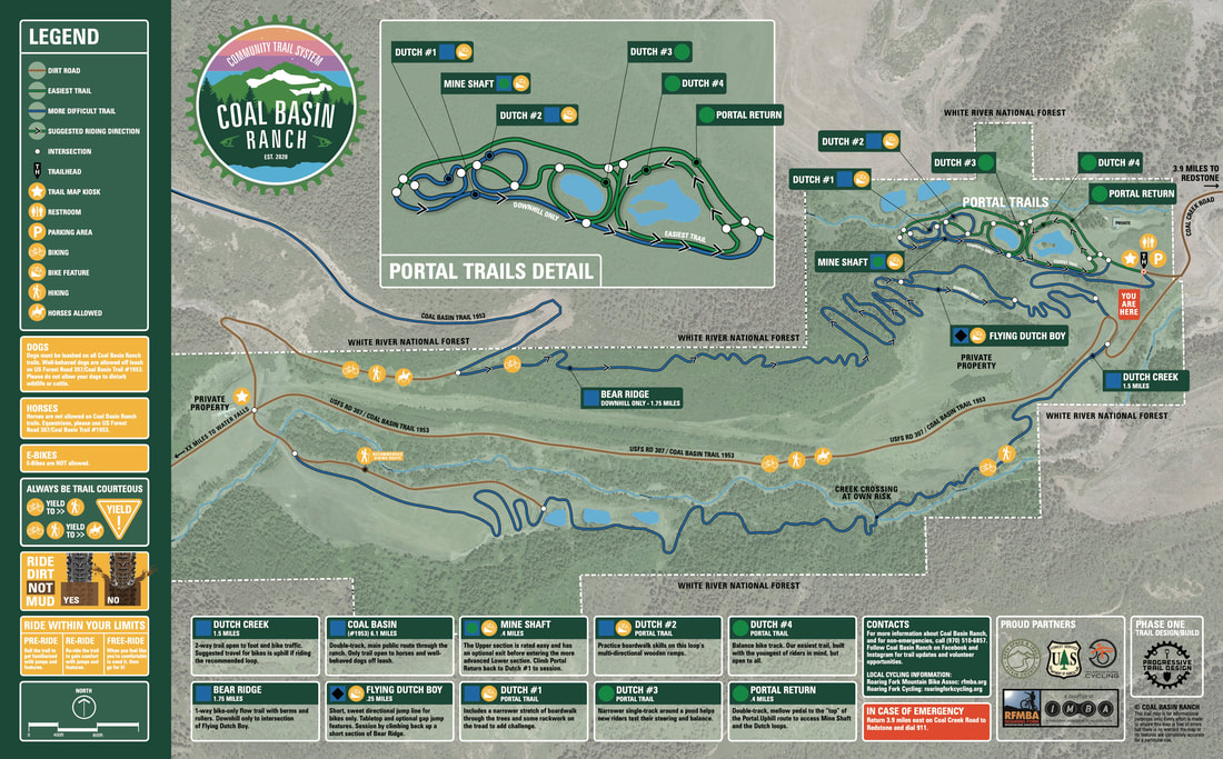
- Coal Basin & Coal Creek Road (FSR #307) (multi-users) Directions:Coal Basin is accessed from Hiway 133, turn right at the Redstone Coke Ovens. To get to the trailhead from Redstone, travel 4 miles up Coal Creek Road (FSR #307) to a White River National Forest Service parking area and road closure. 4 Miles To Info Kiosk.Did you know the old mine road is an up and back ride from the top of Coal Basin Road. The trail takes you through the old Mid Continent coal mining area. It's a steady climb on many reclaimed mining roads, so the platform is very wide though grown-in and then mostly single track. From the single tracks there are meadows that you can explore. At around six miles, the trail ends and you return the way you came up. Avalanche Outfitters offer trail rides from May through October. Contact them at 970.963.1144
- Map of the area: SEE BELOW THIS LIST
Rio Grande Trail
- The RFTA Rio Grande Trail is a 42.4 mile heavily trafficked point-to-point trail that follows along the Roaring Fork River and is good for all skill levels. Dogs on leashes, bikers, hikers, and horseback riders are able to use this trail. Everyone yields to horses. Safety first! When you meet horses on the trails stop, step off the trail and talk to the horseback rider(s). Do not hide yourself in the bushes. Horseback riders will tell you when it is safe to pass. Remember, hikers and bikers and vehicles should yield to horses but they may not - so be prepared! Did you know that hikers and horseback riders use the Rio Grande Trail to access many trails that begin on the valley floor? For example: There is a soft track trail going along the RFTA Rio Grande, leading through Glassier Open Space to the Glassier Equestrian trailhead. This trail takes you from the valley floor up onto the 9,100 acres of the Crown.
Sky Mountain Park and Snowmass Village Horse Trails
Read about the 2021 - 2022 Hiker and Horse Trail Survey Monkey Responses
Read about the 2022 RFVHC RECOMMENDATIONS TO TOSV & COMMUNITY ABOUT THE HORSE & HIKER TRAILS
- Upper North Mesa Equestrian Trail - (hikers and horses). Directions: The trail is accessed from Highway 82, to Brush Creek Road and at the roundabout turn right into the Snowmass Rodeo Parking Lot. Did you know that in the summer of 2021, the RFVHC together with partners improved the top circulating trail. The lower section has improved signage, and the lowest beginning part of the trail is slightly challenging for inexperienced trail riders. The trail is a great 2 hour horseback ride with breathtaking 360 degree views of Snowmass Village, Aspen, and the surrounding mountains. Guided Horseback rides are no longer available through Snowmass Creek Outfitters. Dogs must be on leash at all times on all Town trails, and please be courteous and clean up after your dog. Leash law strictly enforced. Closure: December 1st to May 16th Uses: Equestrian and Hiking Surface: Dirt Length: 2.52 miles. There is an ancient Fen protected and off limits by the TOSV as an ancient site and a water source for wildlife. There is a great picnic spot for lunch intertwined in an aspen grove.
- The Tom Blake Equestrian Trail, (horses only but parts are shared with bikes, pls be careful!) Directions:The trail is accessed from Highway 82, to Brush Creek Road and at the roundabout turn right into the Snowmass Rodeo Parking Lot. ( Caution: Construction! Lack of truck and trailer parking at the Tom Blake Trail Head is a major impediment for horseback riders.) For hiker parking at the traffic circle take the second exit onto Highline Rd. Continue onto Owl Creek Rd. the parking will be on your right. Surface: Dirt Length: 1.47 miles
Did you know that hikers and horseback riders on the Tom Blake Trail can enjoy a mellow trail ride, up and back, entirely shaded in deep Aspen groves? There are sections of the Equestrian Trail that are shared with the multiuser Tom Blake Trail, so please be cautious and aware of possible oncoming bike traffic and several bike route crossings. Dogs must be on leash at all times on all Town trails, and please be courteous and clean up after your dogs. Leash law strictly enforced. One user comments, " The Tom Blake trail is really nice but short. Once you reach the end of the dedicated horse section the next section has an option for horses to continue but at the next section all signs say no horses. It is a problem that needs to be fixed. Right now the only access up to government trail is up Anerobic which is a downhill for bikes." https://bike.gosnowmass.com/trails/tom-blake/
Snowmass Creek and Old Snowmass
- Windstar Ranch ( horses & hikers only). Directions: Turn off Highway 82 onto Snowmass Creek Rd at the Conoco Gas Station, follow to the fork and go left. Follow to the signed driveway to Windstar on the right. Caution: At this time, there is no appropriate truck and trailer parking due to the uneven shoulder of the road where a truck and trailer needs for turn around. At the Windstar gate, there is room to park several cars and room to turn cars safely around. Did you know that Windstar is a Pitkin County Open Space and Trails Easement that we have ridden this ranch for decades. It has running water and is perfect on a hot summer day. The RFVHC is working to improve the turn around parking situation. We will improve the gates as well, working with PCOST and the land owners to allow for a pleasant hike and horse experience.
- INTO THE SNOWMASS WILDERNESS (Hikers, Bikers and Horses) Directions: The parking at the trailheads don’t leave room for trailers and impossible to turn around, so we park down by the bridge where there is usually plenty of room, and then ride up to the trailhead Main Snowmass Creek Trail leading to Snowmass Lake East Snowmass Creek Trail over East Snowmass Creek Pass to Willow Basin West Snowmass Creek Trail to Haystack Mountain Did you know that Snowmass Creek Valley is home to over 23 miles of Equestrian Trails. You can follow meandering creeks toward their headwater and head into the Maroon Bells Wilderness. Enjoy unmatched views from beautiful high alpine basins and mountain passes.The RFVHC recommends that equestrians that are headed into this wilderness area check first with Snowmass Creek Outfitters for seasonal information. You need a fit, strong trail horse to go that far. Guided Horseback Rides are available into the Wilderness and trails near Snowmass Village with Snowmass Creek Outfitters. 970.704.0707. RIDE WITH THE GUIDES!
Thompson Divide
Woody Creek Trails
Woody Creek trailhead above Lenado has serious impassable “ bogs” that are perilous. Being Wilderness, large deadfall trees are a major issue as well on this wonderfully beautiful area being quite problematic for equestrian use as chainsaws are prohibited for public use. Forest service personnel evidently have the sole ability to clear these deadfall trees. I have found the trail impassible as the terrain is extreme, ie bogs, rockslides, impenetrable brush and deadfall, steep drops near the creek etc etc. This trail needs more consistent maintenance. We want to work with the NFS in 2023.
Tin Cup Parking in Lenado - We need information on this truck and trailer parking area. Anyone ?
More Horse Trails in our area....click on this link
https://www.fs.usda.gov/activity/whiteriver/recreation/horseriding-camping/?recid=40405&actid=104
REDSTONE MAP BELOW:
|
2022 Summer Trail Work Public land for recreation has private property called “inholdings” within their boundaries.The inholdings predate the public ownership for generations through homesteading or outright purchase. They are private, not open to public recreation and the owners are every bit as right about their rights as you are about your own lawn. Now you know! No Trespassing !! |
Honoring Ranches in The Roaring Fork Valley
Please send Holly your ranch and its history today! [email protected]
Strang Ranch-
Strang Ranch has been a family run working cattle and horse ranch on Missouri Heights for over 50 years. Mike and Kit Strang have protected the land by placing a conservation easement on it. The Aspen Valley Land Trust holds the easement which keep the fields in agriculture and the activities on the land reflecting and preserving the heritage of working ranches in the Roaring Fork and Colorado River Valleys.
Nieslanik Ranch
The John Nieslanik Ranch is a working cattle ranch with 200 acres of farmed ground nestled at the base of Mount Sopris in Carbondale, Colorado. The family has farmed this property since the 1960’s. Today, John, as well as his four sons, Mark, Marty, Mike, and Matt, are still living in the Carbondale community and are all active in ranching lifestyle. Nieslanik Ranch is part of the AVLT, sustaining beautiful open space ranch lands and ranch lifestyles, for this generation and into the future.
Slideshow * Riding the Trails
Photo of Doc's Benito Bar, Raised by Tom Fuller
The Vehicle That Thinks
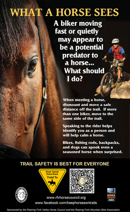
Horses are the only means of transport into the wilderness that has a mind of its own. Because they are large animals with finely-tuned instincts, they can become frightened enough to override their training and in that state become a danger to their rider, themselves and anyone else involved or nearby. This makes equestrians a ‘vulnerable user’ requiring understanding and consideration. Trail etiquette rules specify that other users yield to horses when they are encountered on the trail. This is for everyone’s safety. On the other hand, remember that horses can be trained to charge cannons and are very effective in policing riots. With thoughtful training, they can adapt to most anything.
A letter from Holler Fuller McLain To our Membership:
With new land use changes on BLM and Pitkin, Eagle, and Garfield County lands, it appears to us, little by little, that horseback riding can be wiped off the map for historical recreational use on our surrounding lands. The Horse Council is working on acquiring truck and trailer parking to access our valley trails. We are losing access to horseback trails because the parking areas have been eliminated or the land managers have not planned for additional, designated truck and trailer parking. Many of equestrian’s pull off areas along County Roads are being eliminated. Tickets are being issued to anyone parked illegally. Many existing parking lots are too small for trucks and trailers to maneuver and turn around, and many are taken up by cars leaving no space for equestrians.
To learn more and to follow our active Face Book page with our friends - Go to: www.facebook.com/keephorsesontrails/
The BLM, Pitkin, Eagle, and Garfield Counties need to include equestrians as multi-user trail users and partners.
Please print one cover page of your letter, then as many additional signature pages as you wish, staple them together, to support this important initiative.
Mail your letters of support to:
Holly Fuller McLain
1844 Upper Cattle Creek Road
Carbondale, CO 81623
or call me with questions –- 970 948 2151
Thank you,
Holly Fuller McLain
RFVHC Communication Chairman
|
Parking Horse Trailers at Trail Heads Jon Thompson of the White River National Forest has listed these trail heads as having ample parking for horse trailers. This list is not exhaustive - there are likely many more trails that fit the criteria. The Crown Jewel Trail - two trail heads ( Glassier and Divide Parking Lot) Frying Pan Lakes Twin Meadows (Aspen Norrie and Sawyer) Chapman Gulch South Fork (of the Frying Pan) Savage Lakes Henderson Park (parking along road-turnaround at Savage or Cunningham) Capitol, Hell Roaring, Williams (Hay Park BLM lot) Thomas Lakes Avalanche Perham Creek (tricky entrance, 2 spaces along truck/trailer turnaround, just south of the car parking lot) Beaver Creek (4 Mile Park) Basalt Mountain |
People can also use our online and smartphone app Pitkin Outside www.pitkinoutside.org to locate all trailheads that have equestrian trailer parking. This site brings up all the trails in Pitkin County as well as parking locations. It's very informative of equestrian and parking locations for truck and trailer. You can access this site off a phone as well.
Member gathered trail information:
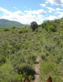
Cozy Point Ranch
Savage Lake Trail: Very steep and rocky. Only 45 minutes to the top for a beautiful view of the lake and great places to picnic. Not recommended for horses. Paul, Shelley and Al
South Thompson Trail: from Broderick trail head: Lovely ridge trail until you cross the creek. Then downed timber and bogs, dangerous to proceed. Before creek try trail up to the right, great trail but we don't know how far or where it goes. We named it Council Trail. Roberta, Al and Shelley
Placita Trail: Trail goes straight up for an hour before it connects with Lily Lake Trail. One can also take Lily Lake Trail to Lily Lake and down to road crossing river. Hitch-hike back to pick up trailer. Long 3-4 hour ride, but beautiful. One bad bushwhack around tree down on Lily Lake. Roberta, Al and Shelley
Fisher Creek Trail on Upper Cattle Creek
Jim Sorensen will happily guide riders on the Fisher Creek Trail on Upper Cattle Creek Road anytime a member wants to ride. RFVHC is “caretaking” Fisher Creek and riders are asked to remove trash and/or trail hazards as necessary (anything not over 50 yrs. old, that is). The ride is approximately 1.5 hrs. and great for novice riders. Parking at the trailhead isn’t great, but much better 1/4 mile up the road. Please call Jim to arrange a ride and for more information.
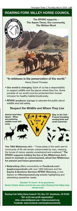
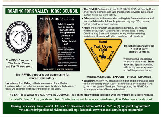
The ads were featured in Aspen Times April 30th, 2020 and the Daily News 2020
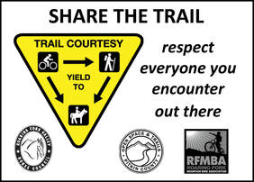
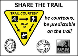
TRAIL SAFETY IS BEST FOR EVERYONE.
SHARE AND ENJOY THE TRAILS IN OUR BEAUTIFUL VALLEY.
7/28/2016
Horse Council applauds Pitkin OST on Glassier Open Space property for equestrian amenities.
On July 28th, two RFVHC Board members rode their horses on the Pitkin OST trail, which is under construction to access 9,100 acres on The Crown.
The proposed parking area for trucks and trailers is not yet completed and not open at this time. However, Gary Tennenbaum of Pitkin OST Staff, told the RFVHC Board members that there will be ample and specific space for equestrian parking.
There is a soft track leading from the newly proposed parking area to the Crown Trail head on the Glassier Open Space land. This kinder surface track parallels the paved RFTA bike path in the “Rails to Trails” transportation corridor. The Horse Council wants to thank Lindsay Utter, Brett Meridith, and the RFTA Board for making this happen. It is an excellent soft track for pedestrians and horses back riders, with only one very small section, where users must cross the paved path to get back on soft track.
The equestrian trail is excellent. The Single Track Trails, contracted by Pitkin OST is making a beautiful trail, using small heavy equipment, and hand raking cutting, and manicuring the switchback track which meanders through the Gamble oak, pinion and juniper stands. It is remarkable that this crew has been thoughtful to include the small detail of leaving the native cactus and wildflowers along the trail edge. Many thanks to Pitkin County OST, Gary Tennenbaum, Ted Obrian, and Single Track Trails for building this magnificent trail with minimal disturbance to our wildlife habitat. The footing is excellent for horses and hikers, because the crew, Mike Tuinstra and Leo Tannheimer, have hand raked rocks and set the trail level into the hill where necessary. Tracey Leese, Forman keeps and eye on trail details, as only a woman can. Hand pruning keeps branches from hitting mounted horseman and leaves clear vision for other on coming riders and hikers. There are two gates between the Pitkin OST trail and the BLM trail system on The Crown. I understand that these gates may be replaced with gates that allow easy opening for hikers and horsemen.
The RFVHC also wants to thank Rheta Strong, Leslie Thomas, and Susan Cuseo for their time and effort spent with Gary Tennenbaum to plot and plan this amazing trail. The RFMBA also had a hand in this trail project, and we want to recognize Mike Prichard for his support of our request for a separate equestrian trail. The mountain bike trail is being completed on The Crown by the same Single track Trails Company and it is independent from the hikers and equestrian track.
This excellent, first, designated equestrian trail with soft track and truck and trailer parking at the Glassier Open Space property demonstrates Pitkin County’s commitment to preserve and protect our Western Heritage through supporting our active and steadily growing equestrian community and the horse industry in the Roaring Fork Valley.
Holly McLain – RFVHC Communication Chairman - Carbondale, CO
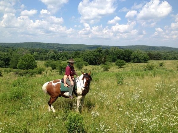
Nina Ware, member and supporter of the RFVHC, riding her horse,
soon to join up for some great riding with other RFVHC members.
soon to join up for some great riding with other RFVHC members.
Sydney Horwitz on The Crown
Sky Mountain Park - Aug. 3rd, 2016
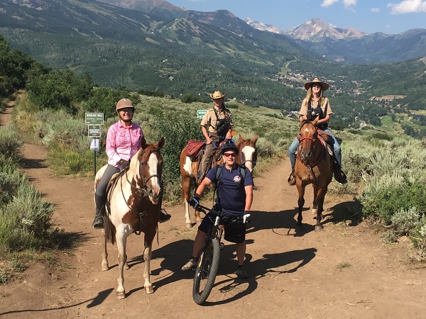
Friends - Bikes and horses
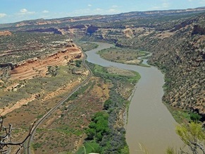
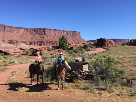
Susan McCoy & Dusty recently rode through the Rabbit Valley in Western Colorado. What incredible vistas on her ride.
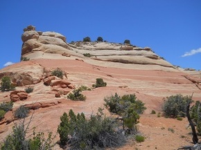
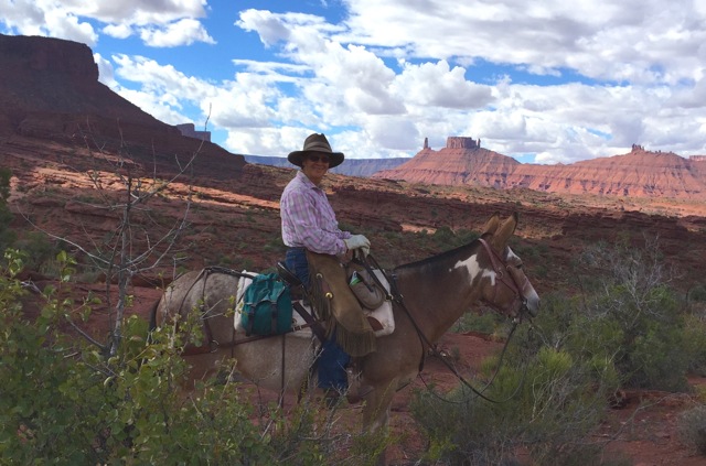
Barb Maxson & Jan Macready - Onion Creek Utah
5 Horse-Friendly National Parks, from Sea to Shining Sea
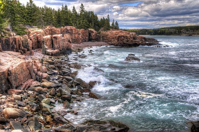
1. Acadia National Park, Maine
Sea meets sky at Acadia on Mount Desert Island in Maine, a more than 47,000-acre reserve containing granite peaks, crashing coasts, green lakes and dense woodlands. It’s also a horse-lover’s paradise, with 45 miles of rustic carriage roads built by philanthropist John D. Rockefeller Jr. in the first half of the 20th century. Today, you can bring your own horse or arrange a scenic carriage ride from the park’s resident Wildwood Stables (running the end of May to mid-October).
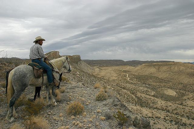
2. Big Bend National Park, Texas
2. Big Bend National Park, Texas
Sheltering more than 450 species of birds, the diverse landscape of Big Bend, in West Texas, houses a rare mix of habitats and geologic features, from desert oases and dinosaur fossils (plus a flying pterosaur and a 50-foot crocodile), to blooming cacti and temple-like limestone canyons. If you’re trucking in, day use is permitted on Big Bend trails including Chisos Mountain and Burro Mesa, or you can overnight with your horse at several of the park’s primitive road campsites.
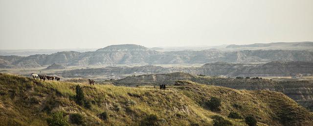
3. Theodore Roosevelt National Park, North Dakota
3. Theodore Roosevelt National Park, North Dakota
In the badlands of western North Dakota, more than 70,000 acres make up President Teddy Roosevelt’s national park, founded in 1947 in his honor (a hunter and outdoorsman, Roosevelt had a longstanding relationship with the region, where he also maintained cattle ranching operations). Wild horses and petrified forest are just some of the wonders visitors can experience in the park’s varied ecosystems, including wide-open prairie, lush river bottoms, buttes, ravines, and more. And the best part? In keeping with TR’s love of riding, almost all of the park is open to horses.
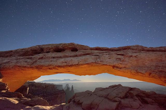
4. Canyonlands National Park, Utah
4. Canyonlands National Park, Utah
Separated into four distinct regions by the Colorado River and its tributaries, Canyonlands National Park is straight out of a Hollywood Western film stage—only it’s the real deal, with Native American rock art panels, mysterious canyons, and towering buttes. Bring your horse for a day-trip in Horseshoe Canyon, or overnight in park quadrants including the Needles, the Island in the Sky, or the Maze—a remote, lunar-like landscape. (Note: lack of water can be a limiting factor for pack trips, so be sure to contact the park in advance for recommended destinations.)
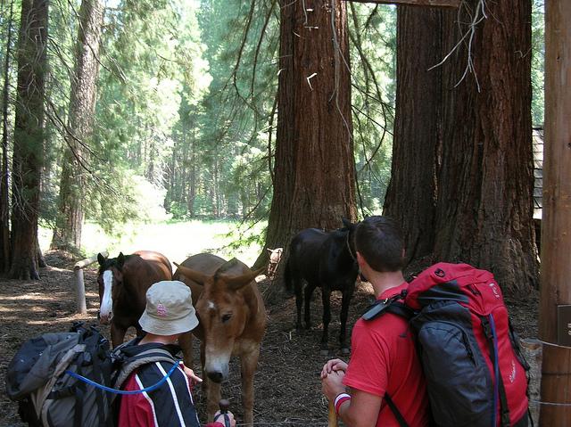
5. Sequoia & Kings Canyon National Park, California
5. Sequoia & Kings Canyon National Park, California
Located in the southern Sierra Nevada mountains, these two, side-by-side parks are home to one of the country’s rare groves of towering sequoia trees. Highlights include General Sherman in Giant Forest, a famous sequoia measuring 275 feet tall; some of the most extensive stands of old-growth coniferous forest on the planet; and Kings Canyon, a glacial valley comprised of tall cliffs, green meadows, river and waterfalls. Strike off with your own horse or take a guided trail ride, available at Grant Grove Stable or Cedar Grove Pack Station in Kings Canyon.
Note: Each national park has its own requirements for “stock use”—including permits required, seasonal trail guidelines, grazing dos and don'ts, and more. These can change over time, so make sure to do your research and contact the park for updates before you go.
Note: Each national park has its own requirements for “stock use”—including permits required, seasonal trail guidelines, grazing dos and don'ts, and more. These can change over time, so make sure to do your research and contact the park for updates before you go.
https://www.guidestar.org/profile/shared/97af3cd1-b9c9-4cd2-8db1-0daa7d81dc14
Roaring Fork Valley Horse Council
PO Box 127
Snowmass, Colorado 81654
* 501 (c)(3) non-profit organization *
[email protected] Facebook: www.facebook.com/keephorsesontrails/
Instagram: www.instagram.com/rfvhc/
Roaring Fork Valley Horse Council
PO Box 127
Snowmass, Colorado 81654
* 501 (c)(3) non-profit organization *
[email protected] Facebook: www.facebook.com/keephorsesontrails/
Instagram: www.instagram.com/rfvhc/

